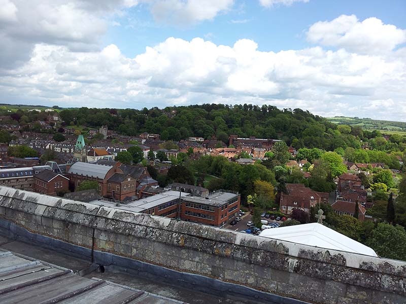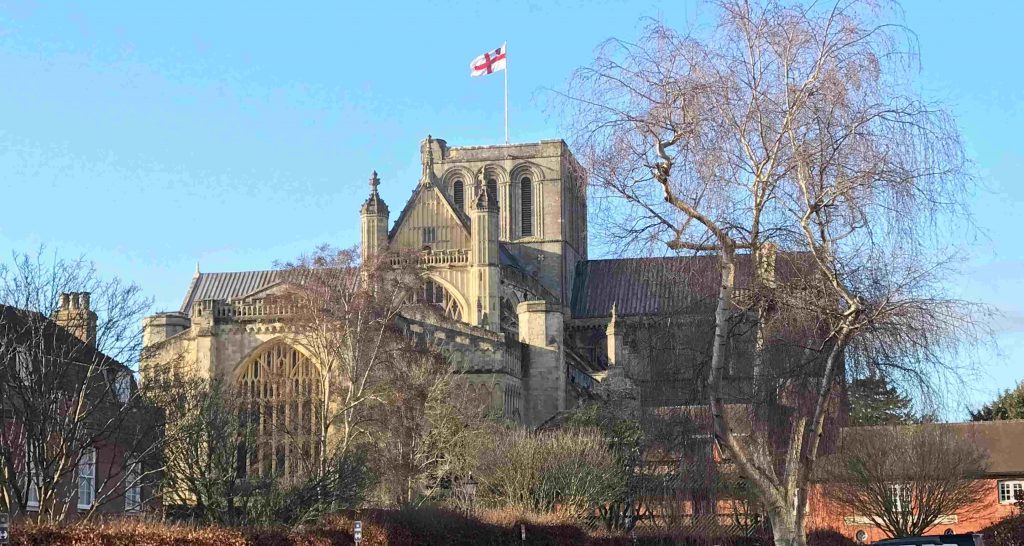
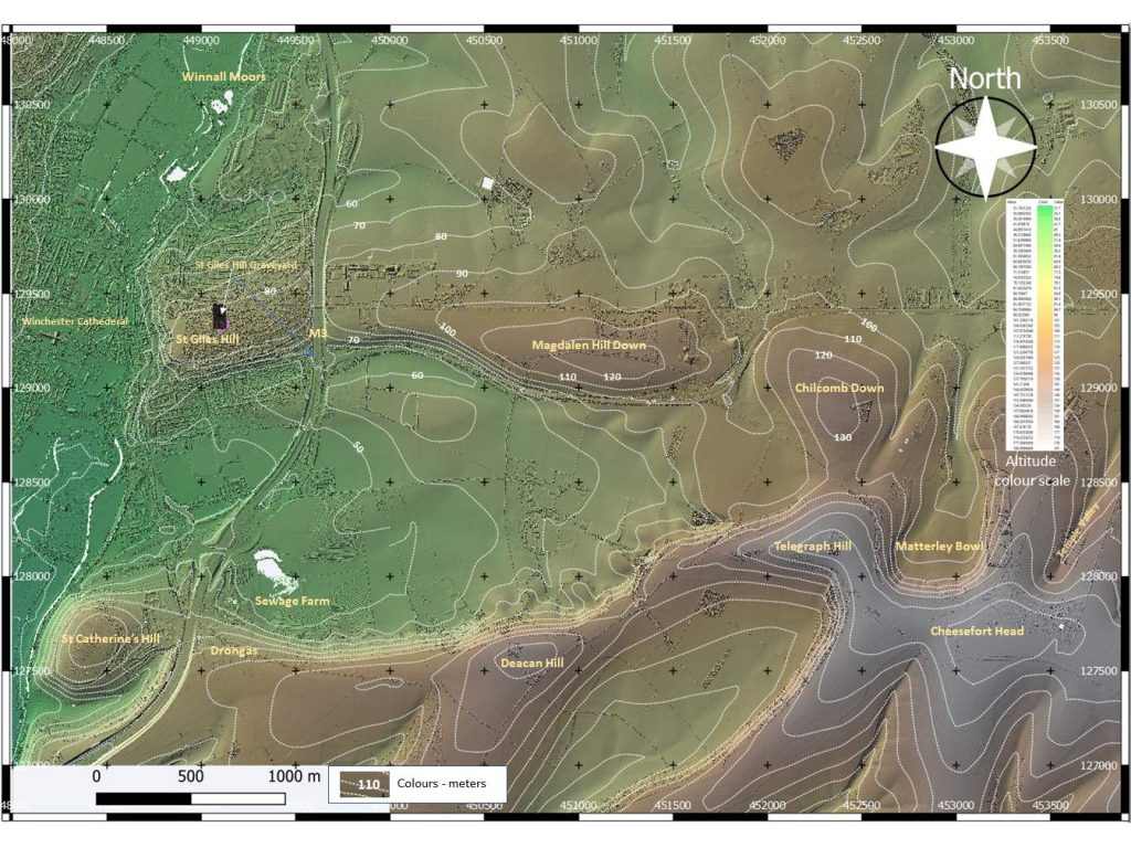
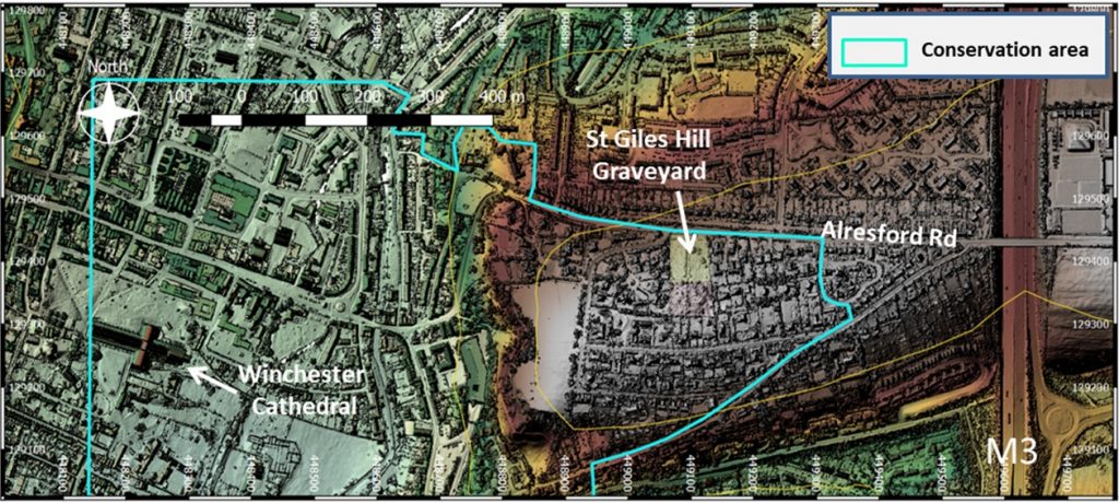
St. Giles Hill is located on the east side of Winchester between town centre and the M3. The eastern slope of the hill overlooks King Alfred’s statue, the Cathedral, and the city High street. The southern slope has good views of St Catherine’s Hill and Twyford Down.
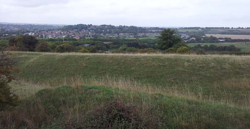
A good view of St Giles Hill and Winchester City can be had from the Drongas on Twyford Down to the south. Magdalen Hill Down forms a topographic extension to the hill to the east. The north looks towards Winnall Moors Nature reserve.
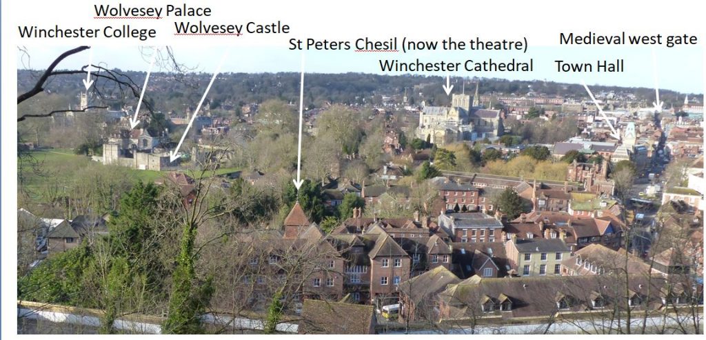
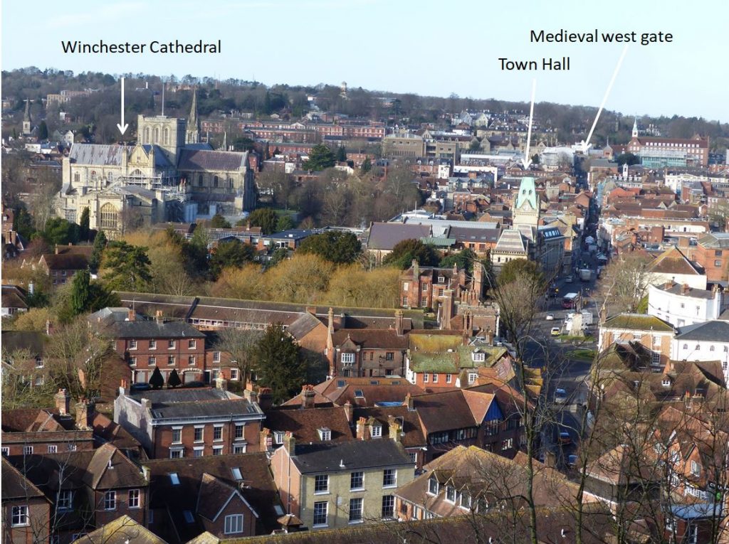
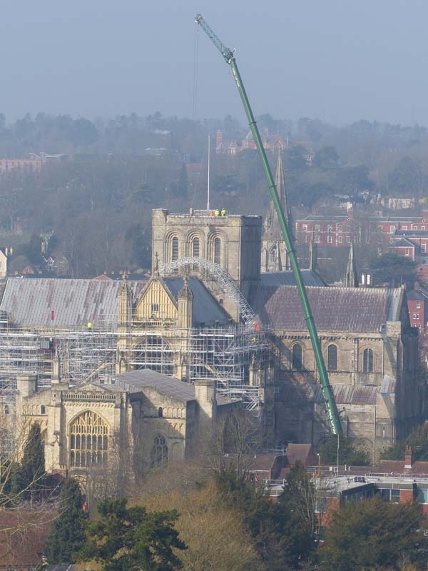
St Giles Hill lies within a large conservation area which includes Winchester Cathedral and the old city centre.
Winchester was an important English town from the Anglo-Saxon period into the Middle Ages. The city was the seat of the Anglo-Saxon monarchs of the kingdom of Wessex, the best known of which is probably King Alfred. The city achieved it’s zenith in the 10th and 11th centuries as the economic centre of England and as a centre of government, the treasury and a royal residency. In later times it’s position as capital city of England was gradually eroded, chiefly by London which took over as the dominant royal centre.
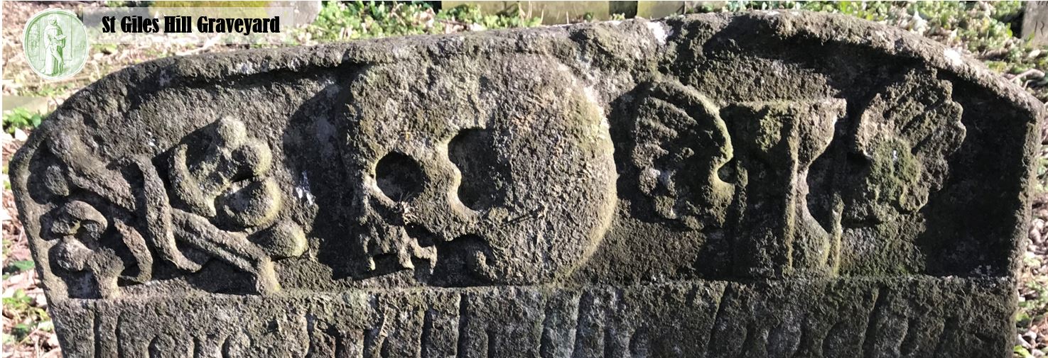
St Giles Hill sits just outside Winchester’s old East Gate (no longer standing). It was first mentioned in 12th-century text in relation to the now demolished St Giles Church. Archaeological evidence suggests it was used by humans from early Palaeolithic times, the Romans, and the Anglo-Saxons for burials.
The hill takes its name from a medieval chapel that stood on the hill and for being the site of St Giles Fair, the largest and most profitable medieval fair in the whole of Europe. The fair was held annually from 1096 on the three days of the Saint’s vigil, the feast day on 1st September and the day following. It reached it’s peak in the 13th century, and thereafter declined. It attracted merchants from many lands. The fair supported a permanent settlement �Nova Villa� whose site included the flat land on top of St Giles Hill and extended eastwards to include Magdalen Hill Down.
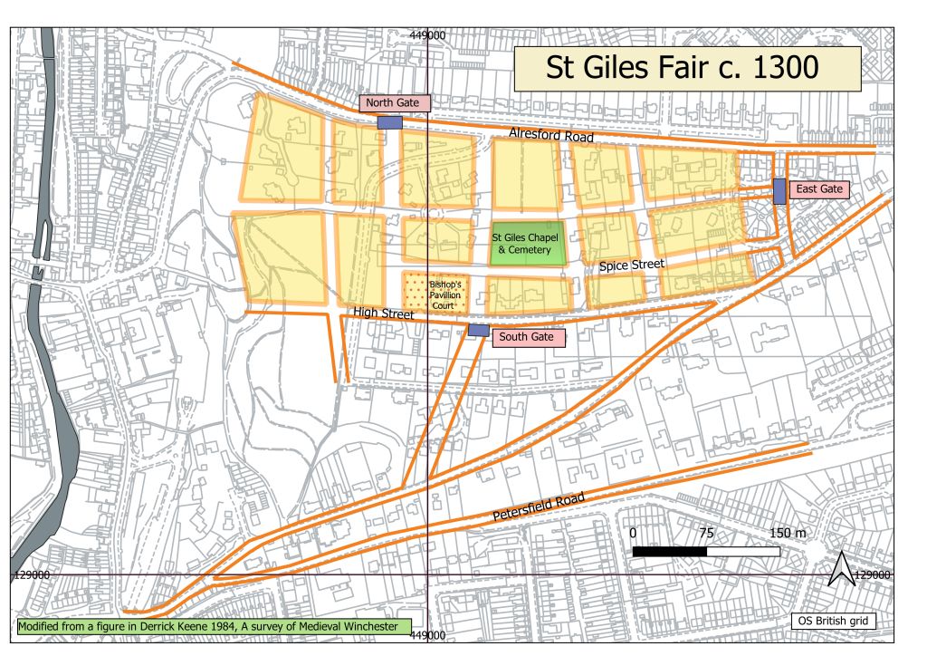
During the days of the fair, all trade in the city was suspended as the Bishop of Winchester and his Bailiffs took control of commercial life. Commerce was only allowed on St Giles Hill, where semi-Permanent streets and shops were constructed. The Bishop earned a considerable income by charging levies from tolls and fines. Its heyday was in the 13th century, but over the years it declined into a local event before finally disappearing at the beginning of the 19th century.