OS benchmarks are survey marks that were used by the Ordnance Survey to make maps. They can be found on walls and buildings across Britain and were a way of recording height at a given point.
Today, our surveyors use GNSS (Global Navigation Satellite System) technology, and it takes just seconds to determine the height and location of a new map detail within a few centimetres, a task which could take days in the past. There are some 500,000 benchmarks on the UK mainland, most no longer in use.
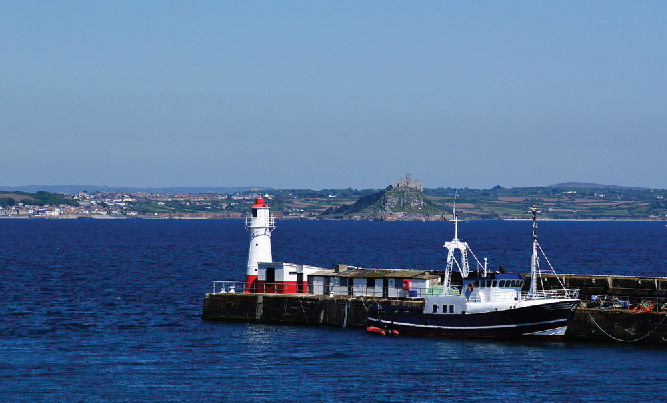
The height of all the benchmarks was established in a process called Geodetic levelling and measures the height relative to an Ordnance Datum at the tidal measuring station at Newlyn in Cornwall.
The link below will take you to a paper in Marine Geodesy “A century of Sea level measurement at Newlyn, Southwest England”.
Article about the Newlyn tidal station.
The Newlyn Tidal Observatory is the most important sea level station in the United Kingdom. It commenced operations in 1915 as part of the Second Geodetic Levelling of England and Wales, and the mean sea level determined from the tide gauge during the first six years (May 1915–April 1921) defined Ordnance Datum Newlyn (ODN) which became the national height datum for the whole of Great Britain.
There were three phases of geodetic levelling. The first took place between 1840 and 1860. This phase did not use Newlyn as the calibration point.
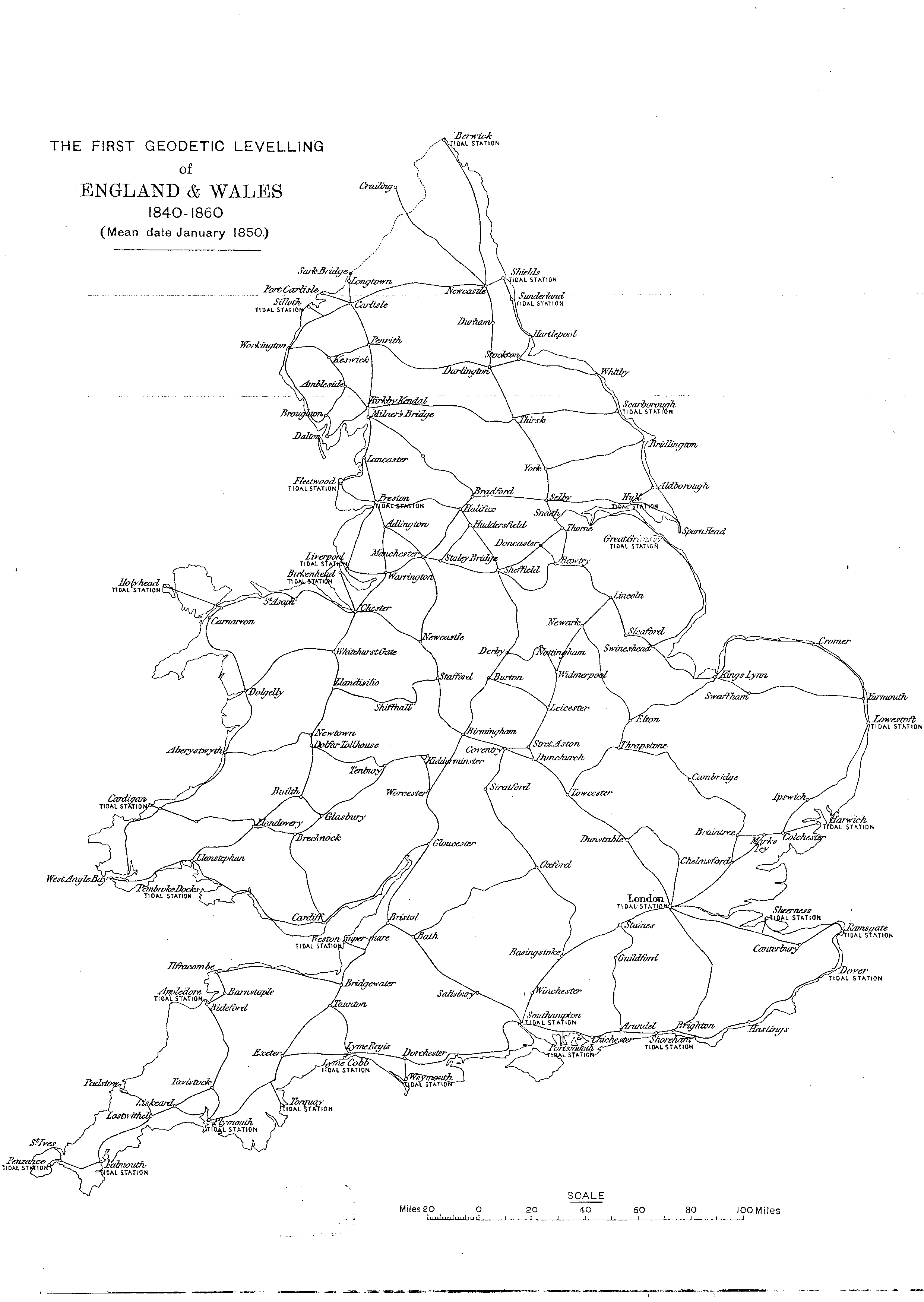
Map showing the grid of lines used to carry out the first geodetic levelling of GB.
The second levelling was carried out between 1912 and 1921 or the third levelling carried out between 1951 and 1956.
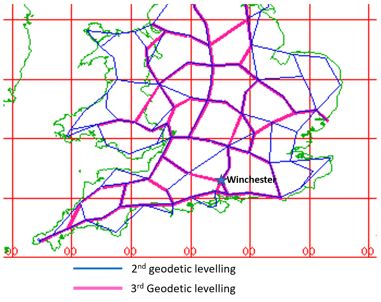
Map showing the grid of lines in the south of GB used to carry out the 2nd and 3rd geodetic levelling’s. Source:- https://www.deformedweb.co.uk/trigs/
The benchmarks come in various formats and with various levels of accuracy. There are a handful of benchmarks on the St Giles Hill. They fall into a number of types, two of which can be seen on St Giles Hill. Cut marks are carved into stone or brick on houses, walls and churches, and Flush Brackets made of cast iron and usually set in brick.
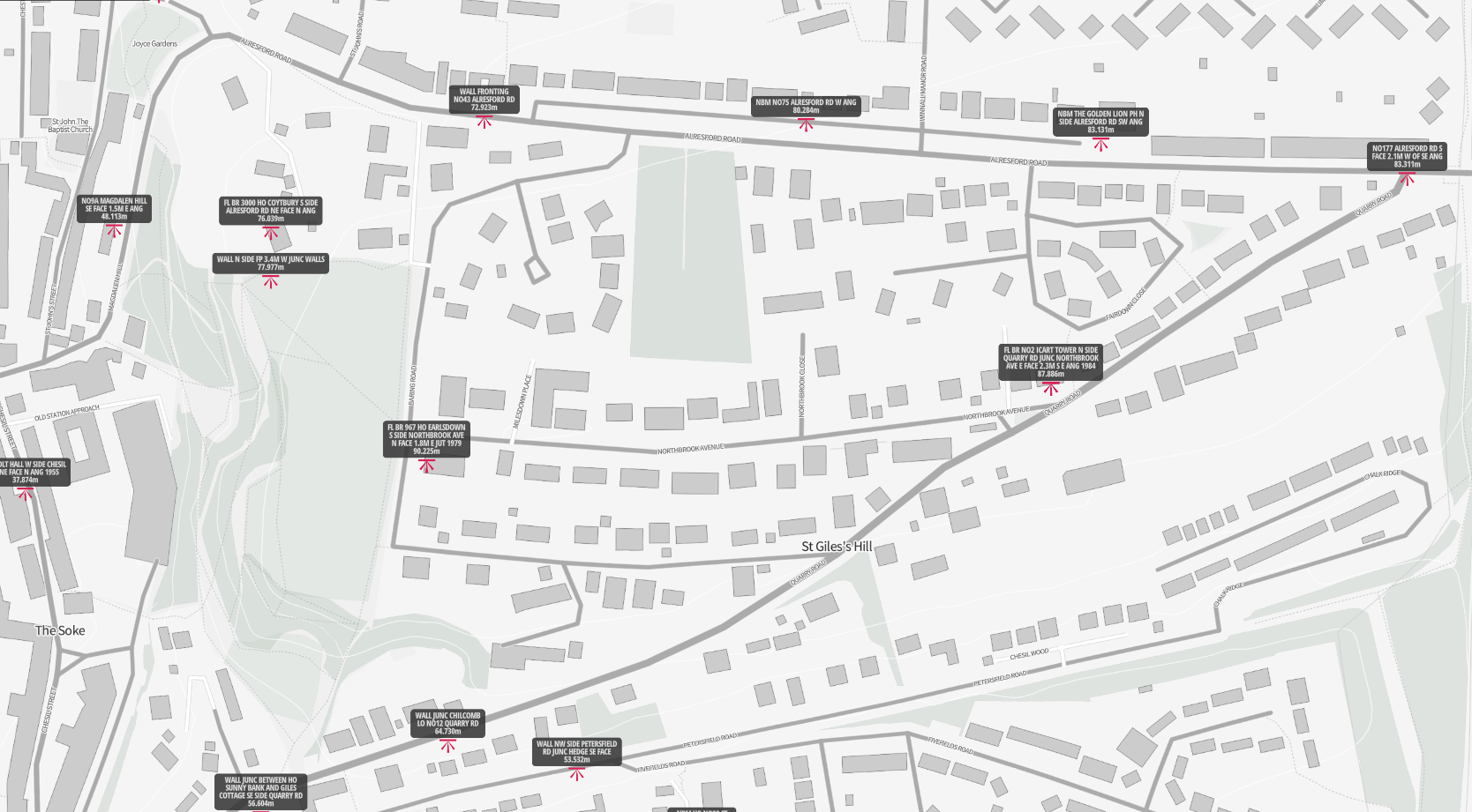
Map of benchmarks on St Giles Hill. source:- https://parallel.co.uk/os-benchmark-archive
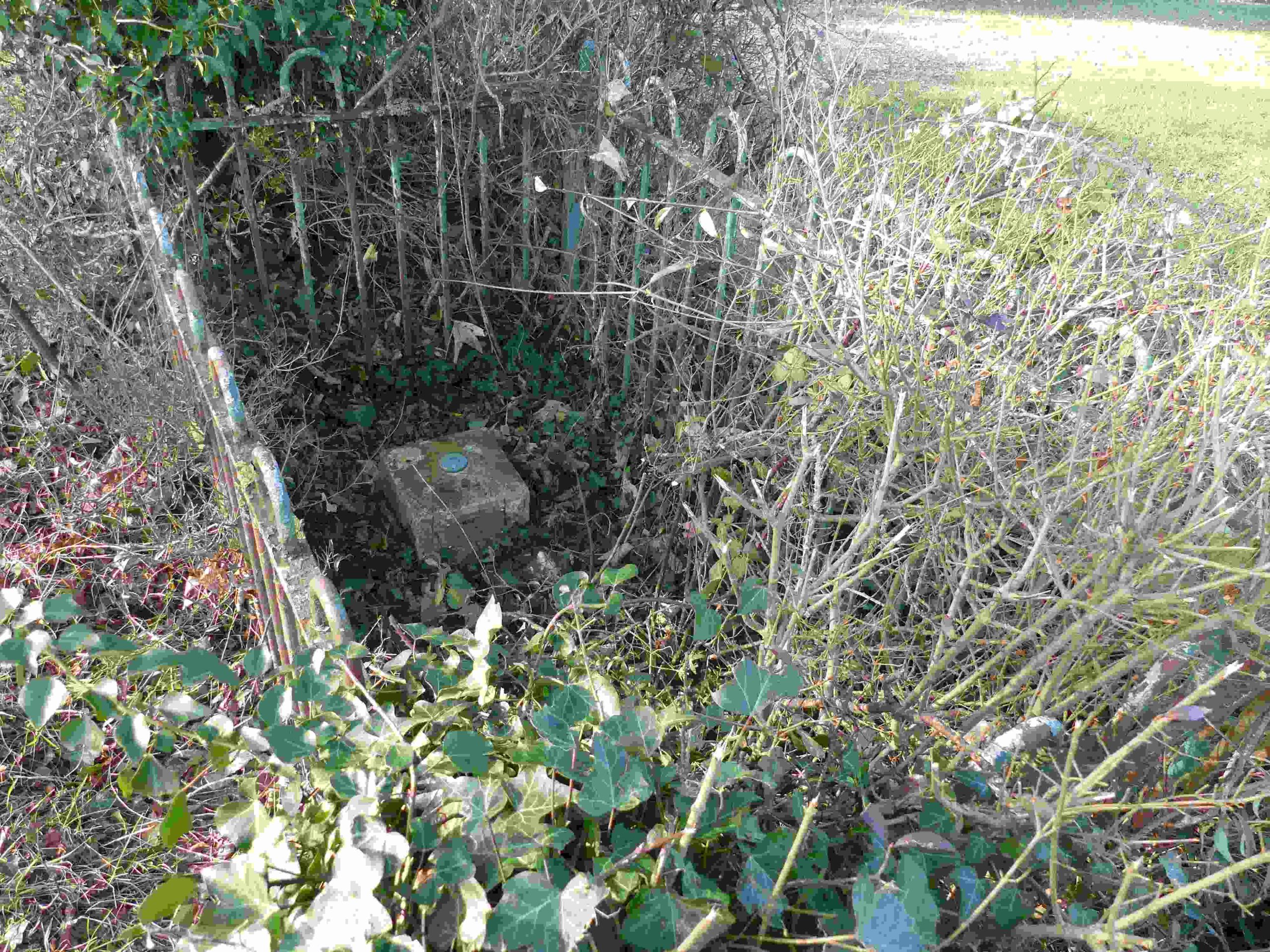
A Flush Bracket (288.339 feet above Newlyn datum) is located on the east face of Water Works on Quarry Rd. This benchmark was used during the Second Geodetic Levelling, England & Wales. It was included on the Southampton to Winchester and the Winchester to Upton Lovell lines. And on Southampton to Winchester via Eastleigh Branch line,
Flush bracket 967 (see photo below) is situated low on a north facing wall of a house (formally called High House) on the south side of Northbrook Avenue near the junction with Baring Rd. The height is 296.020 feet above Newlyn datum.
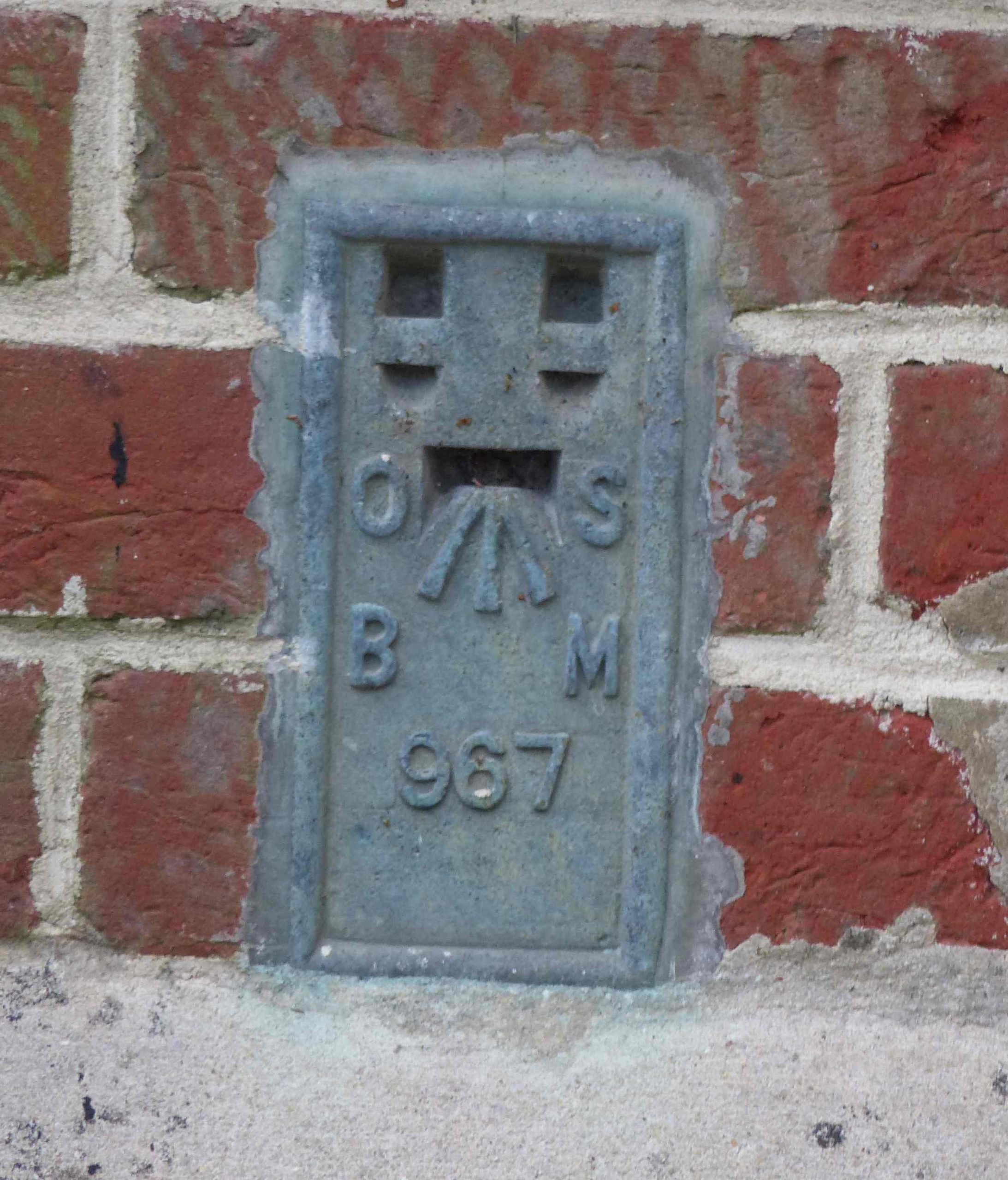
This benchmark was used during the Second and third Geodetic Levelling, England & Wales. In the second levelling, it was included as a side level on the Southampton to Winchester line. In the third levelling it was included in the Fareham to Winchester line, and on the Maybush to Winchester line.
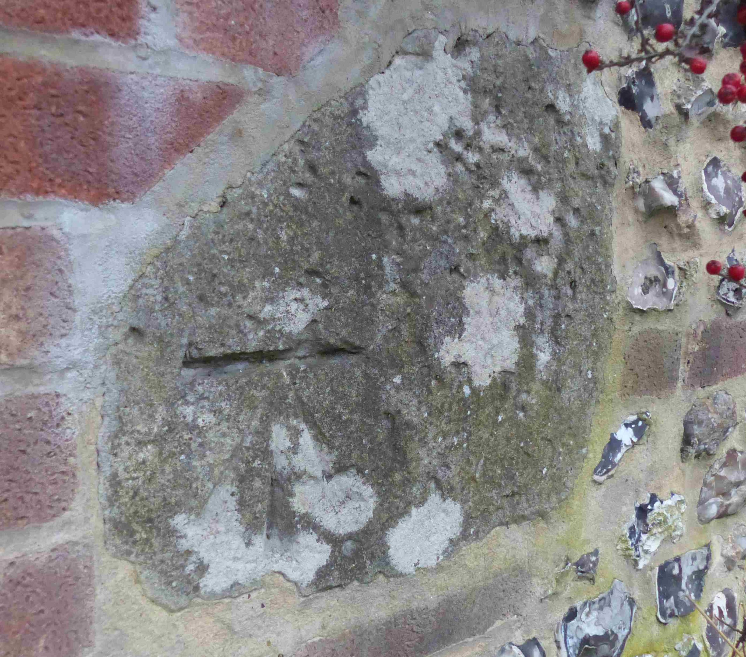
There is an example of a cut mark in stone on the Alresford Rd near St Giles Hill on a wall outside house no. 48.
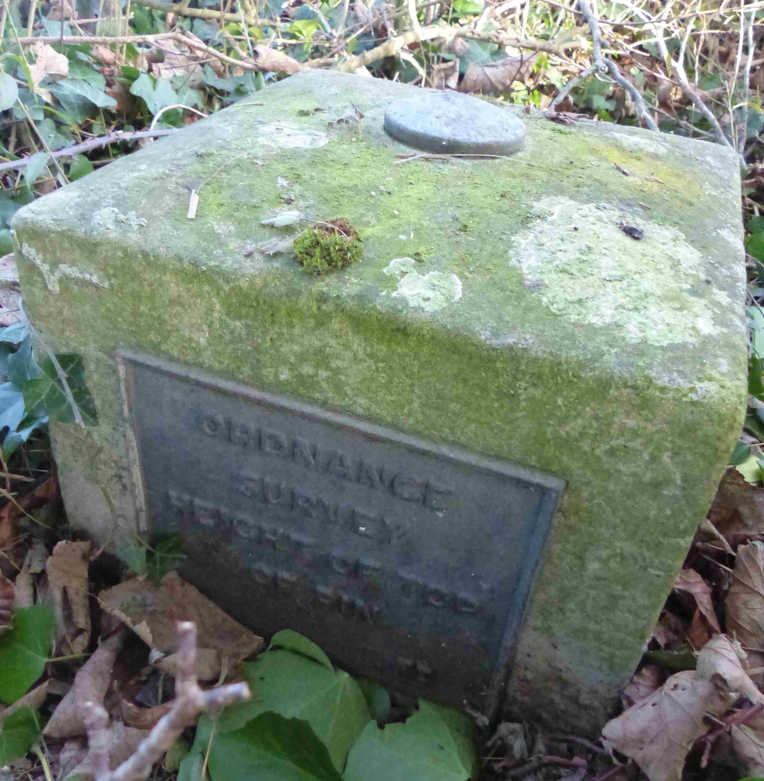
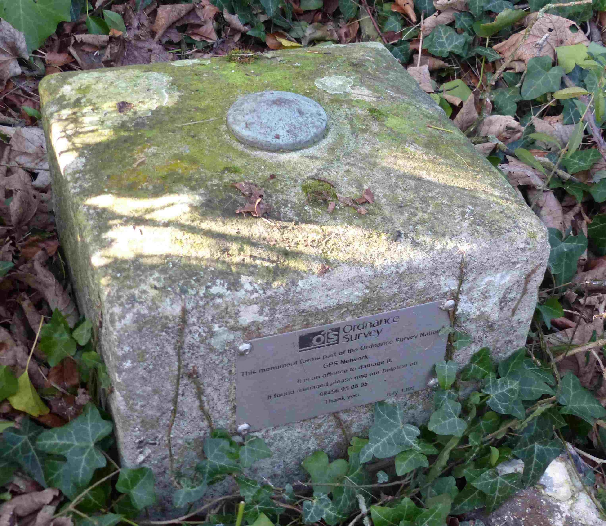
The Winchester Fundamental Benchmark.
The most accurate benchmark and therefore the most important was a Fundamental Benchmark (FBM). The nearest FBM to St Giles Hill is located along the north side of the B3404 on Magdalen Hill Down, known as the Winchester FBM. It was and still is a very important FBM. It is the earliest style of FBM dating from around 1912 and comprising a square pillar with brass top bolt without lettering and a cast plaque on the front (west) referring to the “Height of Bolt”. It also has a 1999 GPS plaque on the back of the pillar. It is surrounded be standard green railings. Many FBM’s are surrounded by railings, often referred to as the “play pen”, for protection.
The around 190 FMB’s were one of the most accurate benchmarks. The height of each FBM relative to ODN was determined by a network of precise levelling lines across the country. The levelling network was then densified with lower-order benchmarks, using less precise levelling.
The visible section of an FBM pillar is usually about 21cm by 28cm and around 30cm tall with a brass bolt set into the top and a nameplate declaring it to be an ‘Ordnance Survey BM’. There is also an underground chamber containing the “master” precise reference marks for the point.
Trig pillars are another form of the benchmark first used in the retriangulation of Great Britain between 1936 and 1953. There are around 7000 of them scattered around Britain. Triangulation is a mathematical process that makes accurate map making possible. In the early 20th century, map making was still based on the Principal Triangulation which was a piecemeal collection of observations taken between 1783 and 1853. The system was starting to collapse and couldn’t support the more accurate mapping needed to track the rapid development of Britain going on after the Great War. The process of retriangulation began on 18 April 1936 by group of surveyors gathered around a white concrete pillar in a field in Cold Ashby.
The nearest Trig pillows to St Giles hill are on Deacon Hill (143m – S2636) and Cheesefoot Head (176m – S1628).